http://www.mtshastanews.com/articles/2007/01/24/news/area_news/03collierproject.txt
Many contributed to Collier interpretive project
by Sibyl Walski, part 2 of 2
January 24, 2007, Mt. Shasta News
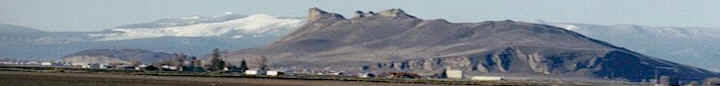
This smart map of the Klamath Watershed,
constructed to scale, is located at the Collier
Information and Interpretive Center on the bank of
the Klamath River south of Hilt. An inconvenient
truth for those who live and work in the Klamath
River Watershed is that the EPA has declared it
the second most endangered river in the United
States.
An unfortunate truth is that most people know very
little about the forces that created and maintain
the watershed and how manmade influences have
disturbed the delicate balance.
A cooperative effort by various state and federal
agencies is tackling the complicated ecological
realities.
A Siskiyou County coalition called the Joint
Powers Authority is addressing the need for public
education at its Collier Information and
Interpretive Center on the bank of the Klamath
River south of Hilt.
After nearly a decade and and half of planning and
study, their answer is an innovative, one of a
kind combination topographical map and movie
screen.
Illustrated and explained on its face are geologic
history, weather patterns, human settlement and
industry, bird and fish migration, animal habitat,
and many other factors.
To heal a sick river system
A group called the Klamath Basin Fisheries Task
Force was formed in 1987, as the result of the
federal Klamath Fisheries Act, to develop a
comprehensive long term habitat reclamation plan
for 170 to 180 miles of the Klamath stretching
from the ocean to Irongate Dam.
The original group consisted of representatives
from the Department of the Interior, the
Department of Agriculture, the Yurok, Hoopa and
Karuk tribes, Oregon and California Departments of
Fish & Game (appointed by their respective
governors), and representatives of the counties
through which that portion of the river flowed.
They gathered data from every source they could to
explain the river's importance to “anadromous”
fish like salmon, which divide their life cycles
between fresh and salt waters, and to help them
identify specific problems that had to be
addressed to restore the river's health.
To educate the public
Public education was an important component of the
plan, but where and how to present mountains of
information in a palatable form to the public
remained problematic.
They began looking for a site at about the same
time (1982) that Caltrans approached the
Associated Chamber of Commerce of Siskiyou County
with a proposal for them to man an information
kiosk at the Collier roadside rest stop, in the
belief a human presence would stop repeated
vandalism.
Because the local chambers of commerce were also
exploring ways to encourage travelers to linger
and explore Siskiyou County, a marriage of
objectives, talents and resources seemed the way
to go.
Alternative plan
The Associated Chamber manned an information kiosk
until 1989, when the Collier group task force took
over to develop an interpretation, information and
education center.
When Caltrans announced a plan to commercialize
rest areas, the Collier group knew it would hurt
businesses in their respective towns along the I-5
corridor and offered an alternative.
JPA replaces Chamber
They got nine incorporated towns and the county to
agree on a task force and endorse a master plan
for the center's volunteer staff to continue their
work.
These 10 became the nonprofit 501 (c) (3) Joint
Powers Authority in 1994, at which time the
Associated Chamber handed over the kiosk and
withdrew from the Collier group.
“If we were going to make the master plan happen,
we needed money. This was the only way we would be
able to be a grant recipient,” explained Bob Rice,
a retired veteran of the US Forest Service and the
county's representative on the JPA board.
It also allows them to receive donations from
private parties.
Planning the approach
“We landed a simple planning grant through the
Department of Agriculture and the U.S. Forest
Service for that phase before we even became the
JPA,” recalled Rice.
The JPA promptly invited those with a
responsibility for Collier and a stake in the
wellbeing of the Klamath watershed and its fish to
partner with it as consultants. As owner of the
rest area, Caltrans was already an involved
stakeholder.
Becoming contributing partners, but not members of
the JPA were the U.S. Department of Fish &
Wildlife, the California Department of Fish &
Game, the Forest Service, the California Highway
Patrol, College of the Siskiyous, and the
California Department of Conservation (Deadwood).
Because of its work on the Upper Klamath
ecosystem, the Bureau of Reclamation in Klamath
Falls was added in 2006.
Making it happen
The JPA also got state recognition under the
California Administrative Code, making it an
official entity with the power to pursue
state-backed funds and grants.
They then concentrated on applying for grants and
clearing the other bureaucratic hurdles: an
official study, site plan development,
environmental reviews, funding, permits, and
leases - the list was long and complicated.
“When we get an idea, it takes us seven years to
make it happen,” said Rice. “This is because we
need to get financing, permits, etc. It usually
takes us five years to get a financial grant.”
One by one, they saw the obstacles go down under
their persistence. Caltrans agreed to a 20 year
lease to replace the yearly renewable one. Its
Redding-based director met with the JPA to discuss
placement of buildings.
The CIIC project, as it became known, obtained
Transportation Enhancement Act funds, McConnell
Foundation grants, private donations and money
from other sources to pay for each step in the
process.
The TEA gave them a challenge grant to build the
central building. To meet their obligation,
Collier sold advertising to raise cash, and the
county council supplied a matching grant, which
together made up the 10 percent required of local
entities toward total construction costs.
The building was completed by a Mount Shasta
contractor in 2002. Inmates from the Deadwood
Conservation Camp built and installed the city
displays for the cost of the materials.
Those displays, representing nine incorporated
towns in the county, are arranged on one side of
the center to encourage travelers to explore the
possibilities of each town. However, the
centerpiece and piece de resistance is certainly
the innovative interpretive map.
Seeing the river as a whole
The seed concept behind the map's message is what
Rice calls “river harmonics.” But one cannot
discuss the river without including the 10 million
acre watershed that spreads over two states and
nine counties, encompassing all possible terrain
to the ocean.
Then there are all the geophysical,
meteorological, biological and political
influences that shape the watershed's peculiar
strengths and weaknesses.
Elaborating on what he means by “river harmonics,”
he said that “legal decisions are often focused on
one segment of the river, which cause negative
impacts on other parts of the river.
“This way we are looking from a holistic viewpoint
at the entire 220 miles of the Klamath River and
its adjacent land base.”
Rice explained that there was so much information
to convey in a time and space-restricted
presentation that the “lesson plan” developed in
stages.
The group gathered ideas from every possible
source, brainstormed at countless meetings,
including an intensive two day workshop, and hired
a professional conceptual designer from Oregon.
From concept to reality
Concept books circulated repeatedly among member
towns and the individuals who were knowledgeable
about the watershed in all its aspects.
At last, the whole concept went to production.
Because the planners had no precedent from which
to work, the finished product is the first of its
kind in the nation - a three dimensional
topographical “smart” map of the 10 million acre
Klamath River watershed set in its geographical
context. This is the canvas upon which successive
layers of history and science can be projected.
The smart map relief was designed to scale in
Portland, constructed in Utah and the audiovisual
CD's done in Los Angeles.
Phase I of the interpretive map of the Klamath
River Watershed is the newest addition, unveiled
last November. The next two phases will use the
same map, but with more advanced information.
Rice described Phase II as being directed to an
eighth grade level of understanding and above.
Both levels are intended to educate not only
travelers, but area students.
Phase III is envisioned as a sophisticated program
which hydrologists and other experts can
manipulate to simulate water flows in drought,
flood and average years.
Weather patterns and fuels, global warming, and
the probable impacts of forest fires and
“silviculture” (forest management) are some of the
ideas Rice has in mind for other Phase III
programs, but those are far in the future, their
development constrained by finances.
The JPA has architectural plans for a viewing
platform to be built out over the Klamath River
that will allow visitors to look down into the
river.
Site plans are in progress for botanical gardens
arranged along paved walkways on the riverbank,
with native plants arranged according to color,
type of ecological niche, uses - such as Karuk
medicine plants - and other groupings yet to be
determined.
“There'll be an elevated viewing platform over the
river itself with a camera focused on the water
that can transmit live pictures inside the center,
plus another camera at Irongate, so visitors can
watch activities at the hatchery,” he explains.
For now, the Phase I program is available. Rice
particularly encourages teachers and school
administrators to use it as a field trip
destination.
“They don't even have to schedule it,” he said.
“They can just come up anytime during the center's
regular hours. And it's free.”
|