http://www.siskiyoudaily.com/articles/2005/01/03/news/news1.txt
Water - It's all about the water
| |
Updated: Monday, January 3, 2005 1:20 PM PST |
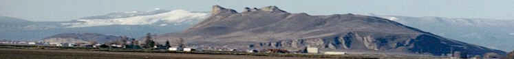
YREKA - With what appears to
be an abundance of rain and snow this time a year,
questions comes to mind such as how do the water
levels compare to last year, and will there be
enough water to get us through the dry months of
summer?
To get an early preview of
the water situation for the coming year, the Daily
News contacted the Bureau of Reclamation in
Sacramento and talked with Public Relations
Officer Jeff McCracken.
Although McCracken said it is still too early in
the season to see the total picture, he can make
some comparisons to previous years.
"We are sitting at 140 percent of normal snowpack
in the Shasta Lake drainage from this time last
year," McCracken said. "At this date, it is pretty
strong. If it stays cold and we hold onto that
snow through the winter and don't get a pineapple
express, we look solid for the water year."
While things are looking good for Shasta Lake and
the Central Valley Project (CVP), the same cannot
be said for the Klamath River.
"The Klamath is only 66-percent of where it could
be, but we have a lot of winter left," McCracken
said. "We can't stop counting now; we are only a
third of the way through the rainy season. Right
now it is up to the weather. If we get natural
precipitation we could be solid."
For the total CVP, McCracken said water storage is
93-percent of the 15-year average, with Shasta
Lake at 80 percent.
"At this point we look at the water in the
mountains, not the water in the reservoirs," he
said. "Shasta fills by rain and we had 125-percent
of average for rain. That is good news."
McCracken said it is still too early to make a
prediction about available water this summer
because it still depends on spring rain. The
Bureau of Reclamation plans to issue its
preliminary forecast for water use on Jan. 21.
"Last year we started out nice and wet like this
year, but it dried up in March and April," he
said.
Shasta Lake, with its primary watershed source in
Siskiyou County, is a part of the massive Central
Valley Project (CVP), originally conceived as a
state project to protect the Central Valley from
crippling water shortages and devastating floods.
California attracted early settlers were because
of its mild climate, abundant natural resources
and scenic beauty. However, the only thing that
seemed to be missing was a reliable water supply.
The state's arid conditions and unreliable
precipitation made it difficult for farmers to
grow crops. By the turn of the 20th century, it
was evident that California not only needed a
special system for water storage and delivery, but
also for protection from periodic floods.
The basic concept and facilities of today's
massive CVP project were formulated in the 1930s.
Work began in 1937, with the Contra Costa Canal,
which began delivering water in 1940. The next
facility built was Shasta Dam, the keystone of the
project. Work on the dam began in 1938, and water
storage started even before its completion in
1945. Congress subsequently passed 13 separate
measures to authorize the development of other
major project facilities over the next three
decades. The final dam, New Melones, was completed
in 1979.
The Major CVP dam and reservoir river system
storage capacity in acre feet are:
€ Shasta Dam and Reservoir and Sacramento River at
4,552,000 acre feet;
€ Trinity Dam and Reservoir and Trinity River at
2,448,000 acre feet;
€ Folsom Dam and Reservoir and American River at
977,000 acre feet;
€ New Melones Dam and Reservoir and Stanislaus
River at 2,420,000 acre feet;
€ Friant Dam and Millerton Reservoir and San
Joaquin River at 520,000 acre feet; and
€ San Luis Dam and Reservoir with off-stream
storage at 966,000 acre feet.
McCracken said that the CVP serves water and
provides flood protection and electricity for
farms, homes, and industry in California's Central
Valley, as well as the major urban centers in the
San Francisco Bay Area. It is also the primary
source of water for much of California's wetlands.
The massive CVP system manages 9 million acre-feet
of water in 20 dams and reservoirs, 11 power
plants, and 500 miles of major canal, as well as
conduits, tunnels, and related facilities. From
that, the CVP provides about 5 million acre-feet
for farms, furnishes about 600,000 acre-feet for
municipal and industrial use, generates 5.6
billion kilowatt hours of electricity annually to
meet the needs of about 2 million people,
dedicates 800,000 acre-feet per year to fish and
wildlife and their habitat, and 410,00- acre-feet
to state and federal wildlife refuges and
wetlands.
Irrigation of agricultural lands in the area now
comprising the Klamath Project was initiated in
1882, with construction of an irrigation ditch to
the land from White Lake. Private interests
further developed the project by constructing the
Adams Canal in 1886, which was supplied also from
White Lake, and the Ankeny Canal in 1887, which
diverted water from Link River. By 1903,
approximately 13,000 acres were irrigated by
private interests.
The Federal Klamath Project now irrigates 240,000
acres of cropland in south-central Oregon and
north-central California. Its two main sources of
water are the Upper Klamath Lake, the Klamath
River and the Clear Lake Reservoir, Gerber
Reservoir and Lost River which are located in a
closed basin. The Lost River and the Klamath River
watersheds are approximately 5,700 square miles.
In 1903 Bureau of Reclamation investigations led
to the development of this federal irrigation
project. Construction began on the Klamath Project
in 1906, with the building of the main "A" canal,
followed by the completion of Clear Lake Dam in
1910, the Lost River Diversion Dam and many of the
distribution structures in 1912, and the Lower
Lost River Diversion Dam in 1921. The Malone
Diversion Dam on Lost River was built in 1923, to
divert water to Langell Valley. The Gerber Dam on
Miller Creek was completed in 1925.
In 1917, the California-Oregon Power Company, now
Pacific Power, was authorized to construct the
Link River Dam for the benefit of the project and
for the company's use. The dam was completed in
1921 and the contract amended and further extended
for a 50-year period in 1956. The Iron Gate and
Copco dams are owned and operated by Pacific Power
and not a part of the Klamath Project.
By JOHN DIEHM