Our Klamath Basin Water Crisis
Upholding rural Americans' rights to grow food,
own property, and caretake our wildlife and natural resources.
Our Klamath Basin
Water Crisis
Upholding rural Americans' rights to grow food,
own property, and caretake our wildlife and natural resources.
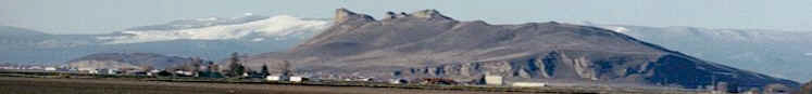
Lakes,
rivers, snow
Published March. 31, 2004 Lake levels Clear Lake - Clear Lake's surface elevation was estimated Monday at 4,526.26 feet above sea level, with storage at 130,790 acre-feet, up 17,680 acre-feet from a year ago. Gerber Reservoir - The surface elevation of Gerber Reservoir was estimated Monday at 4,822.5 feet above sea level, with storage at 49,800 acre-feet, up 16,846 acre-feet from a year ago. River flow Following are daily averages of the volume of water flowing at key points in the Klamath Basin, measured in cubic feet per second: Link River 2004 2003 March 23 786 712 March 24 1,025 719 March 25 1,251 1,085 March 26 1,060 2,323 March 27 1,611 3,945 March 28 1,620 3,671 March 29 1,958 2,887 Klamath River at Keno Dam March 23 1,197 1,012 March 24 1,413 846 March 25 1,251 1,591 March 26 870 2,331 March 27 1,623 2,848 March 28 1,899 3,869 March 29 2,090 2,837 Klamath River at Iron Gate Dam March 23 2,208 1,467 March 24 2,199 1,467 March 25 2,208 1,751 March 26 2,199 1,925 March 27 2,208 3,380 March 28 2,208 4,207 March 29 2,038 3,884 Net inflow to Upper Klamath Lake March 23 2,373 1,884 March 24 2,585 1,891 March 25 2,422 3,039 March 26 2,621 4,670 March 27 2,391 3,554 March 28 2,400 2,107 March 29 2,738 2,496 Williamson River below Sprague R. 2004 Avg. March 30 1,490 1,580 Source: U.S. Bureau of Reclamation, U.S. Geological Survey, Oregon Water Resources Department. Snow report Following are today's estimates of the water equivalent measured in inches in the snowpack at selected sites in Southern Oregon and Northern California. Site Water Avg. Pct. of content avg. Adin Mountain 9.1 13.2 69 Billie Creek Divide 26.4 21.6 122 Cedar Pass 17.2 19.2 90 Chemult Alternate 2.4 5.4 44 Cold Springs Camp 30.7 28.2 109 Diamond Lake 10.7 14.8 72 Dismal Swamp 28.9 28.8 100 Fourmile Lake 29.4 30.6 96 Quartz Mountain 1.0 0.6 167 Sevenmile Marsh 38.3 30.4 126 Silver Creek 5.9 7.9 75 Strawberry 0 4.2 0 Taylor Butte 3.0 2.9 103 Klamath Basin pct. of avg 100 Goose Lake Basin pct. of avg. 84 Source: National Resource Conservation Service
|
Home
Page Updated: Thursday May 07, 2009 06:14 AM Pacific
Copyright © klamathbasincrisis.org, 2004, All Rights Reserved
