Our Klamath Basin Water Crisis
Upholding rural Americans' rights to grow food,
own property, and caretake our wildlife and natural resources.
Our Klamath Basin
Water Crisis
Upholding rural Americans' rights to grow food,
own property, and caretake our wildlife and natural resources.
|
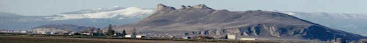
Cozzalio: "As to Mr. Juillerat’s article (below) you asked for comment on, the 'planting' of the reservoirs was always to occur the year of destruction. It was 'expected' to go so well that only 'if' it failed would they need to replant the next year, and regardless of outcome from any second planting, they would only 'observe' for 3 more years to 'see what happens'. Those plantings include many which are noxious such as poison oak, fireweed, and turkey mullein, with some like poison oak being planted exclusively to keep people from accessing the land. As with the other oft repeated photo-ops presenting implied ‘feel good’ misdirection, the seed was portrayed as lovingly ‘locally collected by Native Tribes’. Well paid for doing so, the Project area was never the Tribe’s aboriginal territory, and in fact the vast majority of seed actually came from other regions commercially grown hundreds of miles away. According to press releases, when the spring poppies blooming in certain areas were used for the published special interest photo-op, the planting was proclaimed a 'major success', but when locals posted pictures of the vast majority of everything that died as soon as it dried into concrete, it was 'likely' the fault of 'wild horses brought there by a rancher'. With the apparent failures on land closed to the public, their media efforts have switched to 'building on the success' of the prior plantings by planting yet again. According to their current statements, the ‘restoration’ is a long term active effort, whereas according to the actual original 'plan' and budget, ‘if’ a second planting was considered necessary (which apparently it is), it will only be 'monitored' for a few more years to see what lived. As predicted long ago by actual locals having spent lifetimes improving the environment of their surroundings at their own personal unpaid sacrifice, unless the organics in the sediment manage to provide some long term habitat improvement to isolated moist areas in the resident clay, the ground will all return to the same foxtail and star thistle that surround them and which dominated the clay soil and native plants long ago. However, regardless of outcome, the storyline and self-praise will certainly still resound the major success from those soon moving on once the public money is gone. As far as our location downstream of Iron Gate, virtually EVERYTHING that depends on the river is still completely DEAD. No bugs, crayfish, salmon flies.... Normally goosed by both otters and fish when in the river, a year and a half later I have yet to see a single movement of anything, but of course the river ranges between thick chocolate and the same familiar opaque water I witnessed prior to the major improvements in clarity and nutrient reduction provided by Iron Gate Dam and its deep water Lake. With virtually no visibility, and with the Press Released 'thousands’ of salmon supposedly going past our place, for the first year ever I have not seen a SINGLE CARCASS at our location. Our former diversion which was one of the best deep water refugias in the region and a primary collection site for coho 'capture' prior to destruction, is now gone. Previously 4 to 10 feet deep, after the water goes to normal summer flows our 'swimming hole' looks like it will now be above water level. We still have no irrigation that was supposed to have been replaced long ago but proved impossible due to the horrendous conditions. We have lost most of our pasture and landscape, and even if they actually start the install by the ‘very soon’ we have been told for 5 months, it is unlikely we can get it in before most of what’s left is gone. The osprey's that fight every year over the several nests on our property came, stayed about a week, and have never been seen since as there are obviously NO FISH for them to find or eat in the special interest claimed ‘magnificently successful project’ that supposedly 'flushed the sediment' last winter according to the article, and which others imply is teaming with fish knocking down the doors of Oregon. I can’t speak to the article’s reference to KRRC 'clearing out more sediment' from the river, as that dumping was supposed to have terminated, but again, secrecy prevails. Even according to the original FERC 'plans', their wonderful 'recreational accesses' are a laughable fraction of what was formerly available at the lakes at no public cost. The one thing the article does mention which is true is the dangerous road condition, which is inescapable to ignore, so the article follows up with a 'feel-good' of KRRC public money to fix everything. I previously related the region’s experience to you regarding the failed road contracts and how the County ended up putting itself in a pothole. KRRC in their 'good neighbor' approach was involved in a lawsuit with the County for a major road base collapse that occurred under KRRC’s relentless massive trucking on saturated dirt roads over which KRRC originally assured responsibility but refused to pay. The resultant out-of-court 'new' 2nd modification to previous botched 'agreements' now absolves KRRC entirely from all future responsibility for the roads they were originally going to 'leave better than they found', in exchange for giving the County 3.5 million total ratepayer/taxpayer dollars for the County to do it themselves... an amount that won't even begin to touch bringing the roads back to the terrible condition they were originally, but which at least fills a portion of the pothole the County dug itself. No one is even mentioning the fact that Ager Road, the 'alternate highway' to I-5, has also been severely impacted from the massive and constant hauling, but that's apparently ok since it's the Signatory Governor’s California taxpayers that will eventually pay for it. As far as I know, the far worse issues and losses the residents at Copco are dealing with regarding water wells and structural damages are also still ‘a work in progress’, and of course their life altering losses in property values were never even acknowledged. I also understand long term wells have suddenly gone dry just outside KRRC’s self-determined lake impacted ‘boundaries’. Apparently KRRC’s response was, in one of the wettest years on record, that the wells must have gone dry due to ‘climate change’ for which they are not held responsible. So far EVERY SINGLE THING we predicted and fought against for 30 years has come true and then some, including the betrayals and ongoing outright lies to the public. What a surprise…. Nonetheless, I sincerely hope we are wrong in the rest of those predictions for what’s yet to come." --------------- ------------------------------------ ----------------------------------BEAUTIFUL BANKS New growth along Klamath River off to good start LEE JUILLERAT for the Herald and News 5/14/25 Spring and the ongoing removal of massive amounts of concrete, earth, rock and clay from the channel of the Klamath River are creating a new look. And, according to the Klamath River Renewal Corporation (KRRC), which is overseeing revegetation work along areas impacted by the removal of four hydroelectric dams — John C. Boyle, Copco 1 and 2, and Irongate — from the mainstream river, “fish once again, have access to more than 400 stream miles of habitat in the Upper Klamath Basin, including tributary creeks and streams.” KRRC also has released a series of Spring in the Reservoir Reach photos, showing the greening of areas that had been reservoirs created behind the dams. “Based on last year’s amazing restoration success, we have high hopes for this restoration season,” KRRC said, adding, “the new growth has certainly gotten off to a great start.” Native seed mixes were applied to the reservoir footprints as the draining began in January 2024. According to KRRC, the initial round of seeding was intended to stabilize sediments and improve soil composition. After the reservoir drawdowns, the exposed lands were planted with more than 66,000 pounds of native seed; 77,000 bareroot, plug and container plants; and more than 25,000 acorns. In the fall and winter of 2024, restoration crews planted another 34,000 pounds of native seed, upping the total planting to more than 100,251 pounds of native seed, 115,000 bareroot, plug and container plantings, and 25,000 acorns. KRRC said rain this winter and spring “has provided ideal conditions to flush additional sediments down river as well as promoting the growth of native vegetation.” The replanting efforts are continuing with crews currently doing another round of seeding, planting and weeding. In addition, KRRC said it is implementing the Recreation Facilities Plan approved by the Federal Regulatory Commission (FERC) with construction happening at five recreation access sites along the restored reaches of the Klamath River at the former Boyle, Copco and Iron Gate reservoir areas. The five sites are expected to be fully open by August. The sites include two in Oregon near Keno and three others along the river in California. The Oregon locations include Pioneer Park West and Moonshine Falls while the California site are Copco Valley, also known as K’utarawax-u or Grizzly Hill; Fall Creek, also known as K’ucascas; and Iron Gate. “We understand the high interest in visiting sections of the Klamath River that were inundated for up to a century, and we believe your patience will be rewarded with incredible new recreation experiences later this summer and in years to come,” KRRC’s statement says. Until fully opened, four sites will be open during specific hours with limited amenities — limited parking, limited river access, port-a-potties, no seating areas — beginning Thursday, May 15. Areas will still be in construction with the limited opening “so users must respect all fencing and signage. No trespassing will be allowed outside of the designated access site.” People wanting to visit the areas are advised to visit the recreation page of KRRC’s website at klamathrenewal. org/recreation. Pioneer Park West will open Thursday, May 15, with limited parking along with limited river access, porta- potty and no seating areas. It will be open daily from 7 a.m. to 7 p.m. with full opening expected Aug. 1. Moonshine Falls, however, is not expected to open until late spring/early summer with limited parking and limited amenities. Full opening is expected by Aug. 1. Copco Valley (K’utarawax- u or Grizzly Hill), will open May 15 with limited parking and limited amenities with hours Monday through Friday from 12:30 a.m. to 1:30 p.m. and 5:30 to 6:30 p.m. Gates will be open only during designated hours. Users will not be able to enter or exit the site outside of the designated hours. Full opening is expected August 1. Fall Creek (K’ucascas) will open May 15 with limited parking and limited amenities. Accessing the temporary site will be from Copco Road across the Daggett bridge. It will be open daily from 7 a.m. to 7 p.m. with gates open only during those hours. Its permanent opening is expected Aug. 1. Iron Gate will open May 15 with limited parking and limited amenities, including limited river access. Hours will be 7 a.m. to 7 p.m. daily with full opening Aug. 1. According to the report, Copco Road is in very poor condition and its use is discouraged. According to KRRC, it and Siskiyou County made an agreement last December with KRRC paying the county $3.5 million and the county agreeing to take ongoing responsibility to improve and maintain the road.
==================================================== In accordance with Title 17 U.S.C. section 107, any copyrighted material herein is distributed without profit or payment to those who have expressed a prior interest in receiving this information for non-profit research and educational purposes only. For more information go to: http://www.law.cornell.edu/uscode/17/107.shtml |
Page Updated: Monday June 16, 2025 11:06 PM Pacific
Copyright © klamathbasincrisis.org, 2001 - 2023, All Rights Reserved
